

What We Offer
Our Services
Precision surveying and engineering services delivered with advanced equipment, qualified professionals, and a commitment to accuracy on every project across Saudi Arabia.
Core Disciplines & Specialist Services
Umer Hayat Contracting provides a comprehensive range of surveying and engineering services to clients across the oil & gas, infrastructure, renewable energy, and urban development sectors. Our three core service disciplines — Land Survey, Engineering Survey, and Construction Survey — are complemented by specialist capabilities in UAV drone surveying, ground penetrating radar, underground utility mapping, and 3D laser scanning.

Land Survey
Accurate spatial data for planning, development, and legal compliance.
Our land survey services provide the foundational spatial data required for any development or infrastructure project. Using advanced GPS/GNSS receivers and total stations from LEICA, SOKKIA, and TRIMBLE, we deliver precise, reliable results for clients across Saudi Arabia.
Scope of Work
- Topographic surveys — detailed terrain mapping for planning and design
- Boundary demarcation — precise marking of land parcel boundaries
- Cadastral surveys — land registration and ownership documentation
- Land subdivision — division of parcels for development or sale
- GPS/GNSS control networks — high-accuracy reference frameworks
- Contour mapping — elevation data for drainage and earthworks design
Typical Applications
- Urban and residential development
- Industrial and commercial land parcels
- Agricultural and rural land
- Government and municipal projects

Engineering Survey
Spatial data that engineers and project managers can build on.
Engineering surveys provide the precise spatial data that underpins infrastructure design, route planning, and project delivery. Our team works closely with engineers and project managers to ensure survey data is accurate, timely, and fit for purpose.
Scope of Work
- Route surveys — alignment data for roads, pipelines, and railways
- Pre-construction surveys — baseline data before works commence
- Cross-section surveys — cut and fill calculations for earthworks
- Utility corridor surveys — mapping of existing services and infrastructure
- Hydrographic surveys — water body and drainage channel mapping
- Volume calculations — earthwork quantity assessment
Typical Applications
- Road and highway projects
- Pipeline and utility corridors
- Railway and transportation infrastructure
- Oil & gas facilities and refineries

Construction Survey
Precision setting-out and monitoring throughout the construction lifecycle.
Construction surveys ensure that structures are built exactly where they are designed to be. Our setting-out and monitoring services support contractors and project managers throughout the construction process, from initial peg-out through to final as-built documentation.
Scope of Work
- Setting-out — precise positioning of structures, foundations, and infrastructure
- As-built surveys — documentation of completed works for record and compliance
- Structural monitoring — deformation and settlement monitoring
- Pile positioning — accurate location of piles and deep foundations
- Floor level surveys — slab and finished floor level verification
- Façade and alignment surveys — verticality and alignment checks
Typical Applications
- Commercial and residential buildings
- Industrial facilities and plants
- Infrastructure and civil works
- Oil & gas and petrochemical facilities
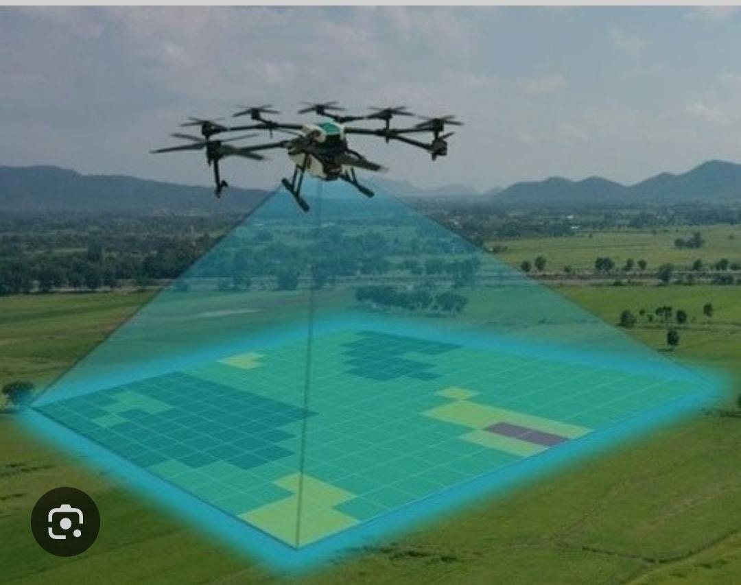
UAV Drone Surveying & Aerial Mapping
High-resolution aerial data for large-area surveys, mapping, and site monitoring.
UAV Drone Surveying and Aerial Mapping involves the use of unmanned aerial vehicles to capture high-resolution aerial data for land surveying, topographic mapping, site assessment, and infrastructure development. Drone-based surveying delivers rapid, accurate results across large areas that would be time-consuming or difficult to access by conventional ground methods.
Scope of Work
- Aerial topographic mapping — high-resolution terrain data from above
- Large-area land surveys — efficient coverage of extensive sites
- Construction site monitoring — progress tracking and change detection
- Digital terrain modelling — accurate DTM and DSM generation
- Orthophoto mapping — georeferenced aerial imagery
- Volumetric calculations and earthwork assessment
Typical Applications
- Large-scale land development projects
- Infrastructure and road corridor surveys
- Mining and quarry volume assessments
- Solar and renewable energy site surveys
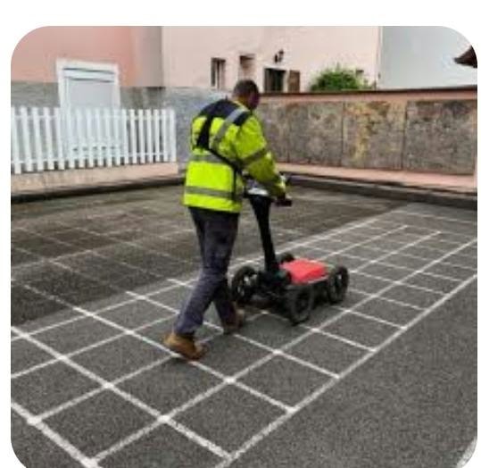
Ground Penetrating Radar (GPR) Survey
Non-destructive subsurface investigation for underground utility detection.
Ground Penetrating Radar technology uses electromagnetic signals to investigate underground conditions and identify potential buried utilities and subsurface features. GPR surveying is a non-destructive geophysical investigation method that supports infrastructure development, construction planning, and utility investigation while reducing the need for unnecessary excavation.
Scope of Work
- Underground water pipeline detection and mapping
- Sewerage and drainage network investigation
- Electrical cable and telecommunication duct location
- Buried infrastructure and subsurface anomaly detection
- Subsurface structure investigation
- Concrete scanning for embedded objects and reinforcement
Typical Applications
- Pre-construction utility investigation
- Infrastructure and road development
- Oil & gas facility surveys
- Urban development and municipal projects
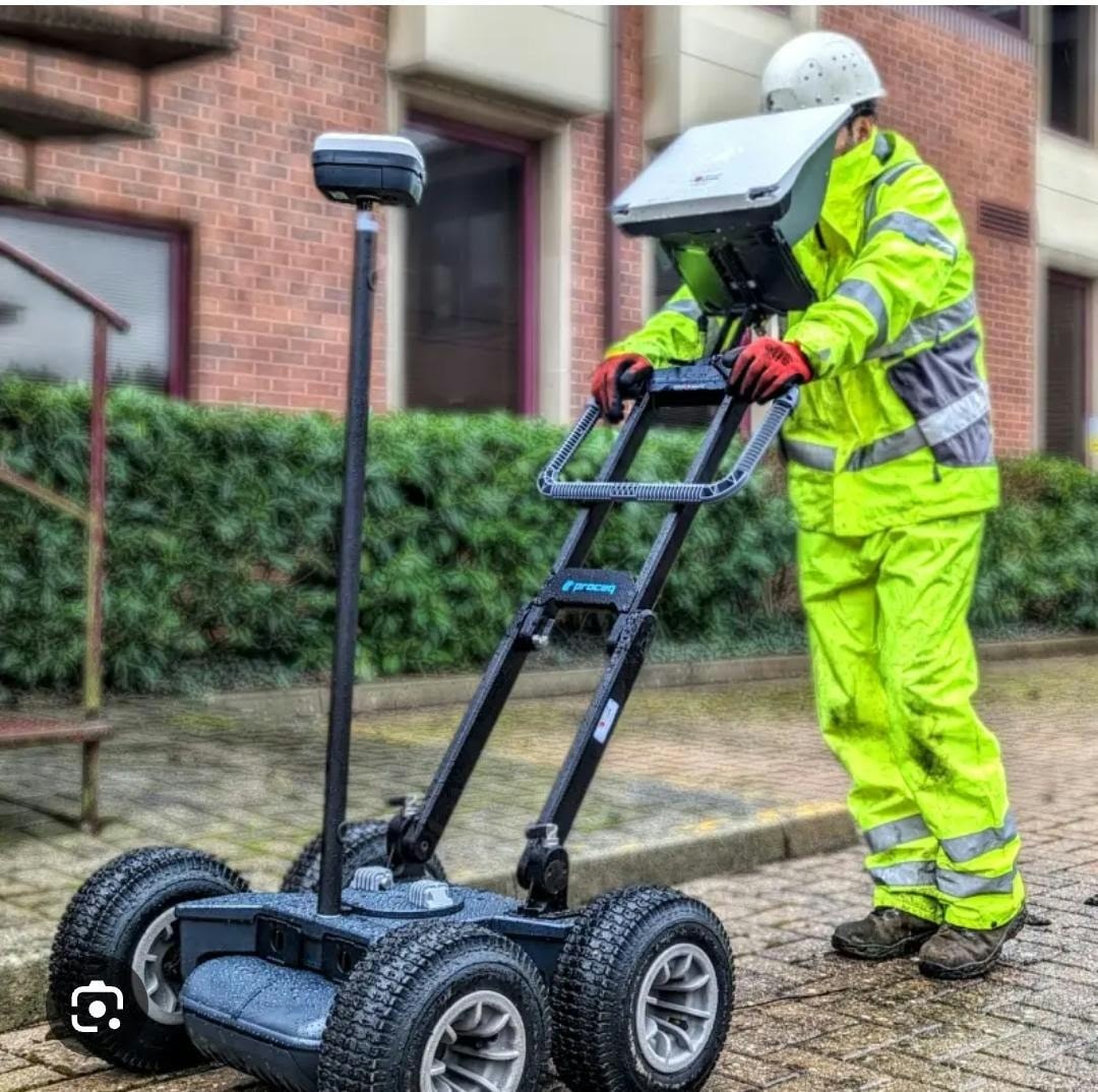
Underground Utility Mapping
Comprehensive mapping of buried infrastructure to support safe construction.
Underground Utility Mapping provides information about existing buried infrastructure to support safe construction, engineering, and infrastructure development. Using suitable geophysical survey equipment and professional interpretation methods, underground investigation helps identify the location and approximate depth of buried utilities and other subsurface features.
Scope of Work
- Utility detection — locating buried cables, pipes, and ducts
- GPR data collection and subsurface radar measurement
- Underground infrastructure surveys for construction planning
- GPR data processing and professional interpretation
- Utility mapping plans and professional survey drawings
- Digital survey deliverables in standard CAD formats
Typical Applications
- Pre-excavation utility clearance
- Infrastructure and pipeline corridor surveys
- Road and highway construction projects
- Industrial and Royal Commission facilities

3D Laser Scanning
Millimetre-accurate 3D measurement, point clouds, and as-built documentation.
3D Laser Scanning captures millions of precise measurement points to create a detailed digital representation of any structure, facility, or environment. This technology delivers highly accurate as-built documentation, supports clash detection, and enables BIM integration for complex engineering and construction projects.
Scope of Work
- High-density point cloud data capture
- As-built 3D documentation of structures and facilities
- BIM-ready deliverables and 3D modelling support
- Structural deformation and dimensional verification
- Façade and heritage structure recording
- Industrial plant and pipeline as-built surveys
Typical Applications
- Oil & gas plant and refinery documentation
- Industrial facility as-built surveys
- Building and infrastructure BIM projects
- Heritage and architectural recording
Our Instruments
Survey Equipment & Technology
We invest in the best instruments available to ensure our data meets the highest accuracy standards.
Total stations, GPS/GNSS receivers, and laser scanning systems for the most demanding survey applications.
High-accuracy total stations and digital levels for precise engineering and construction surveys.
Advanced GPS/GNSS systems and data collection solutions for efficient field operations.
Our Approach
How We Work
Project Briefing
We meet with you to understand your project requirements, agree on deliverables, accuracy standards, and programme.
Field Survey
Our qualified surveyors mobilise to site with the appropriate equipment and carry out the survey to the agreed specification.
Data Processing
Raw field data is processed, checked, and quality-assured in our office using industry-standard software.
Deliverables
Final survey drawings, reports, and data files are delivered in your required format — on time and to specification.
Discuss Your Survey Requirements
Tell us about your project and we will advise on the most appropriate survey approach, programme, and cost.